Improved satellite-enabled buoys could make a splash in ocean science
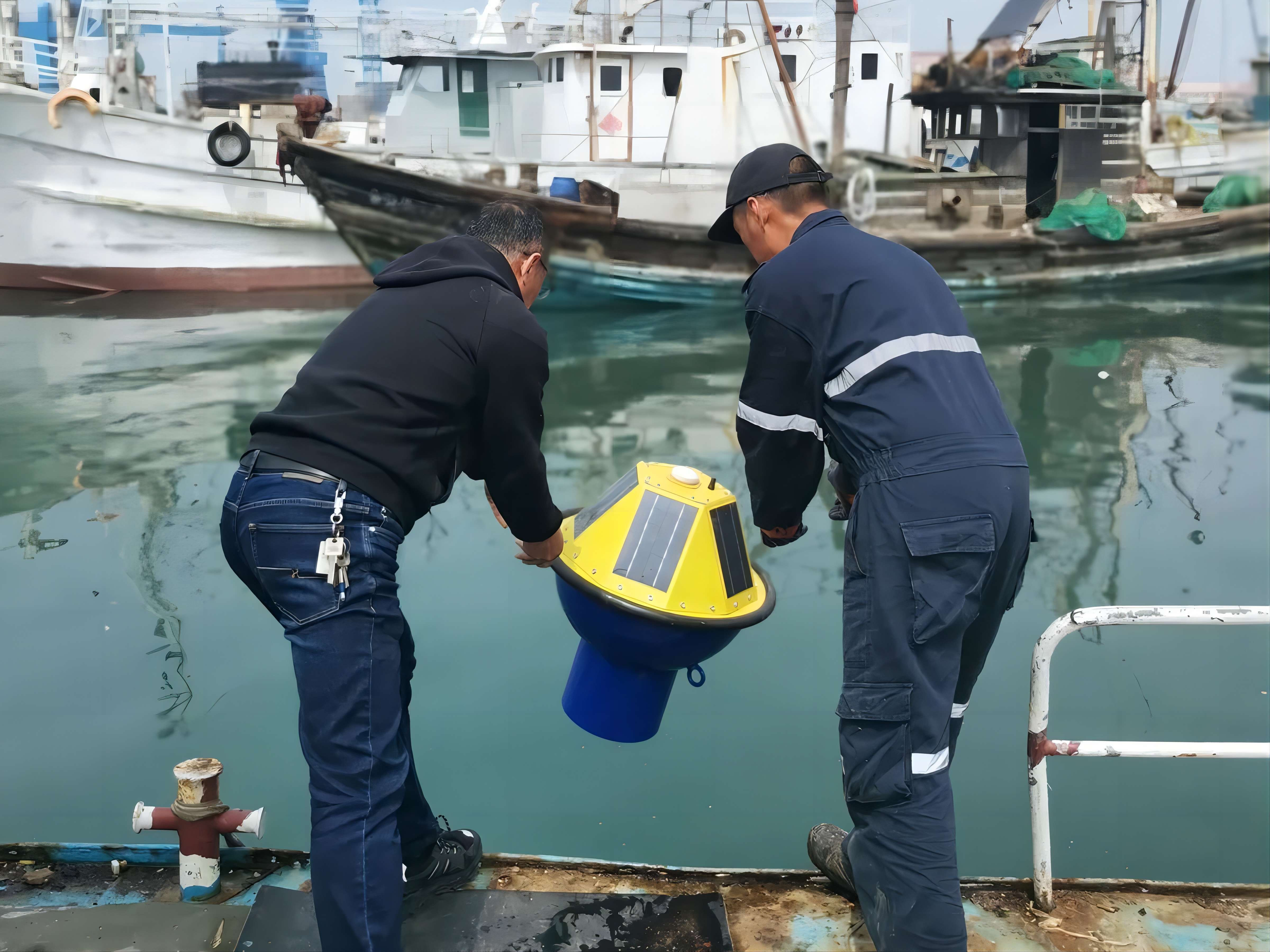
Sensor-equipped buoys can easily be deployed with a toss overboard. YONGSHENG XU
This article is part of our exclusive IEEE Journal Watch series in partnership with IEEE Xplore.
Oceanographers need precise measurements of waves and currents when studying the seas. To collect this data, researchers turn to buoys equipped with sensors that can operate as floating field stations. The buoys are designed to measure the movement of water across the ocean surface, and the speed and size of ocean waves. To operate in the open sea, these buoys use GPS and other satellite data in place of land-based reference points.
Despite their usefulness, however, only a small number of these ocean-wave buoys have been deployed. That's because they're expensive and require complex calculations to process the data, which are done with expensive onboard computational equipment and can take several days to complete.
To address these issues, a team of researchers in Qingdao, China, has built a new kind of buoy. Like other wave buoys, their device uses global navigation satellite systems (GNSS) technology. But instead of gathering dual-frequency satellite data—the current standard—their technology achieves lower costs, better accuracy, and real-time computation with single-frequency analysis. The researchers described their approach in a study published 19 March in IEEE Transactions on Geoscience and Remote Sensing.
Dual-frequency satellite data collects data in two separate frequency bands. It is typically used to achieve more accurate measurements than data using a single frequency band; adding a second frequency band can correct for disturbances in the atmosphere, though it takes longer to process.
While satellite data alone can deliver some information about ocean dynamics from afar with remote sensing, it lacks the accuracy of direct observations. In fact, GNSS buoys were initially developed as a calibration tool themselves, to improve satellite measurements of tides and global sea-level change over a long period of time, says study author Yongsheng Xu, a researcher at the Institute of Oceanology, Chinese Academy of Sciences, and an IEEE member. Researchers then realized they could use the buoys for measuring wave period, height, and direction directly from the ocean. "The discovery that high-frequency GNSS data also contains vital wave-motion information...has extended the utility of these buoys beyond their initial purpose," Xu says.
"Only with a sufficient number of observations can we better understand and forecast ocean waves."
—YONGSHENG XU, CHINESE ACADEMY OF SCIENCES
Current GNSS buoy designs take several different approaches to processing the data. Some buoys calculate the buoy's vertical velocity from the Doppler shift, as measured by satellites overhead. Other methods examine acceleration from onboard the buoyand achieve precise measurements by including either a land-based reference station or downloading information about the satellite's orbit and timing from its onboard clock, Xu says. However, this means that the buoys have to be within 50 kilometers of the shore, in the case of a reference station. Downloading extra satellite data adds a burden on the buoy's bandwidth and computational resources.
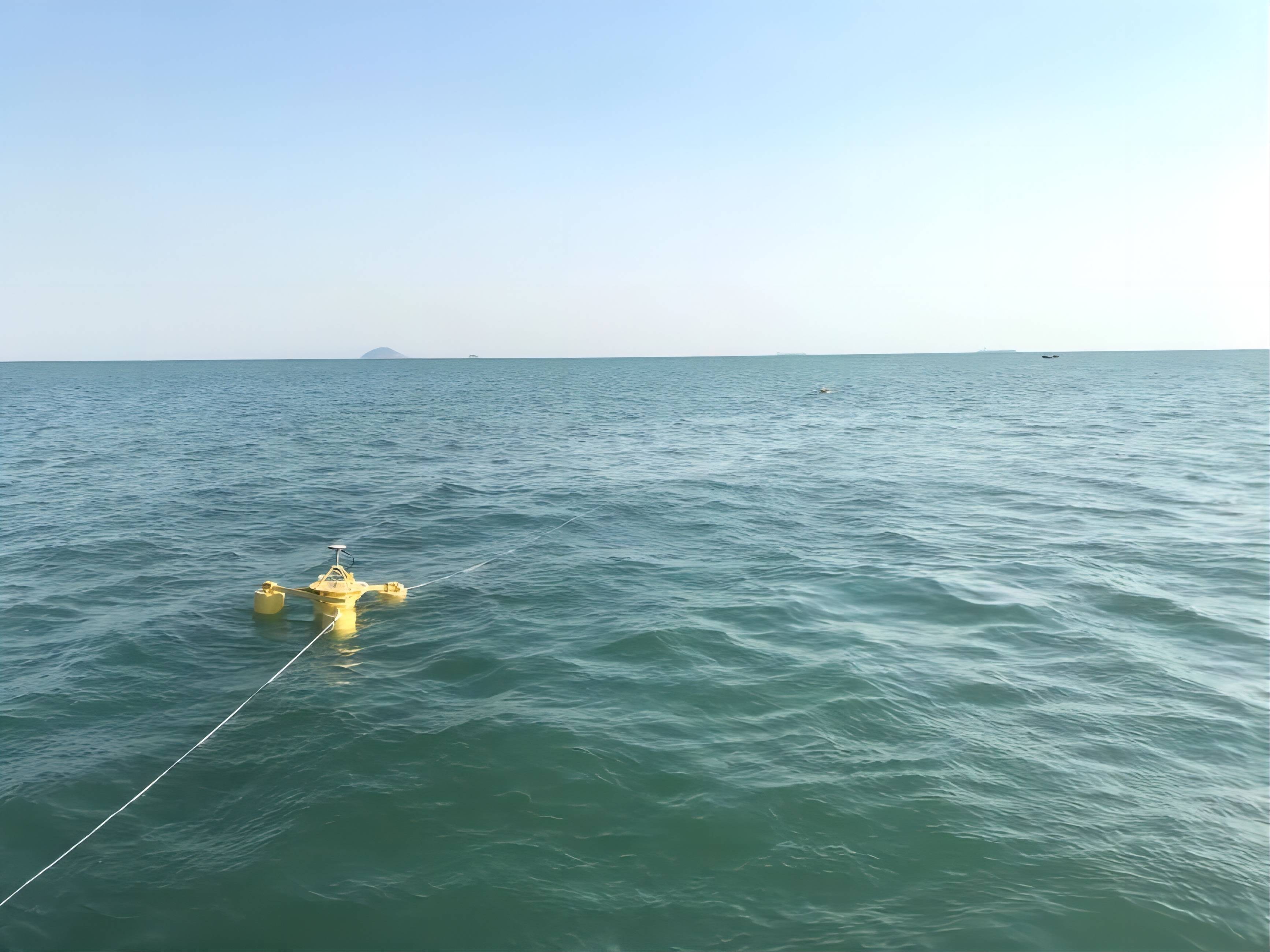
The researchers tested their buoys off the shore of Qingdao, China. YONGSHENG XU
The Qingdao researchers' buoy takes the satellite-based principles, but uses a single-frequency GNSS chip—a cheaper alternative to their dual-frequency counterparts, which are currently used in the buoys. Switching to single-frequency also showed slightly higher accuracy. The dual-frequency approach involves additional computation that can inadvertently amplify measurement errors, Xu explains.
In the researchers' approach, an algorithm uses the single-frequency GPS signal to measure the buoy's velocity in three dimensions, which is used to find its displacement and therefore the size of the wave. While other methods require postprocessing that can take several days—sometimes up to a week—this approach can be done in real time and doesn't require external data downloads. Compared to the Doppler-shift method—the only other method that can be done in real time—the single-frequency method was five times as accurate in the researchers' tests.
The single-frequency chips also cut down on costs; Xu estimates their buoy costs about one-tenth the price of other wave buoys. Reducing the cost means scientists could deploy a large network of buoys, including off the shores of lower income countries. Scaling up the number will allow for better monitoring of waves across the globe, in line with the United Nations' goal to make the 2020s an "ocean decade" and increase attention on ocean science.
"Ocean waves vary significantly in space and time," Xu says. "Only with a sufficient number of observations can we better understand and forecast ocean waves." Reducing the cost of wave buoys could make this possible.
The researchers are currently working to address a key challenge: maintaining the satellite link. The harsh sea conditions and stormy weather can affect the buoys' ability to maintain a direct line of sight to receive the satellite radio signal, which is essential for the buoys to function, Xu says. The researchers aim to improve the mechanical design of the buoys to address this in the future. (IEEE Spectrum)
Original Link: https://spectrum.ieee.org/ocean-buoy