The Bohai Sea is proposed as the center of deformation associated with destruction of the North China Craton (NCC), and its tectonic history is essential for understanding the evolution of craton in response to oceanic subduction.
Many seismological studies in the NCC mostly provided constraints on the deep mantle structure of the NCC, which focused on differences in evolution between the eastern and western parts of the NCC. However, the shallow lithospheric deformation beneath the Bohai Sea region is still not well constrained, which is important for better understanding the localized lithosphere modification in the eastern NCC.
Recently, the research team led by Prof. DONG Dongdong from the Institute of Oceanology of the Chinese Academy of Sciences has resolved the depth-dependent azimuthally-anisotropic structures of the shallow lithosphere beneath the Bohai Sea region by anisotropic ambient noise tomography and provided critical insights into the regional tectonic evolution and deformation field of the eastern NCC.
The study was published in the international journal Tectonophysics.
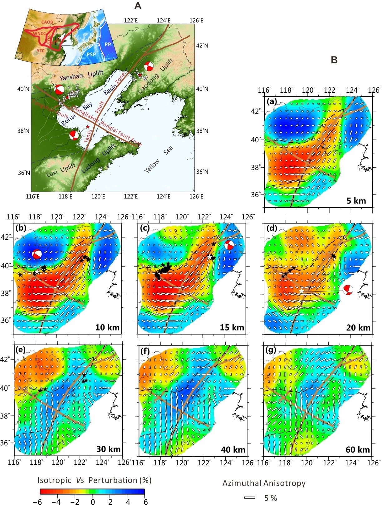
Researchers presented high-resolution 3-D azimuthally-anisotropic shear-wave velocity structure of the crust and uppermost mantle using direct inversion of Rayleigh-wave phase-velocity dispersion from ambient noise. The N-S fast wave direction and relatively high velocity anomalies observed in the uppermost mantle beneath the Tanlu fault zone, as well as prominent Moho uplift, supporting the conclusion that the Tanlu fault zone has facilitated lithospheric modification of the eastern NCC since late Mesozoic.
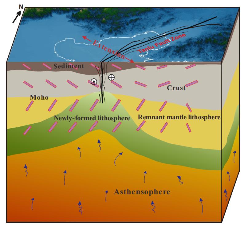
Anisotropy images also indicate that the northern and southern Bohai Bay Basin have undergone different deformation histories. The strong and consistent azimuthal anisotropy within the uppermost mantle beneath the southern Bohai Bay Basin may originate primarily from re-orientation arrangement of the olivine induced by new lithosphere, which may mostly result from rapid cooling of upwelling asthenosphere due to the subduction of the (Paleo-) Pacific Plate.
"Our tomographic model can depict intuitively the spatial extent of lithospheric modification and replacement in the Eastern NCC, that is, newly-formed lithosphere with distinct azimuthal anisotropy is recognized at depths of 30-60 km in the eastern NCC," said LI Cuilin, first author of the study.
"This is an interesting study that provides new constraints on the crust and sub-Moho mantle structure of the eastern NCC using ambient noise, especially the Bohai Sea region, where anisotropy structural feature is poorly resolved due to limited seismic data," said Prof. DONG.
The research was funded by the National Natural Science Foundation of China.

Fig. 1 Tectonic units and fault systems in the Bohai Sea region (A). Lateral variations of isotropic Vs perturbation and azimuthal anisotropy (B).

Fig. 2 Cartoon model illustrating modified lithospheric mantle including newly-formed lithosphere and remnant mantle lithosphere beneath the Bohai Sea region
Li, C.*, Feng, J.*, Fan, J., Dong, D., & Dosso, S. E. (2022). Seismic anisotropy evidence for modified lithosphere below the Bohai Sea region, eastern North China Craton. Tectonophysics, 823, 229192.
LI Cuilin
Institute of Oceanology
E-mail: cuilinli@qdio.ac.cn
(Editor: ZHANG Yiyi)
|
|

Address: 7 Nanhai Road, Qingdao, Shandong 266071, China
Tel: 86-532-82898902 Fax: 86-532-82898612 E-mail: iocas@qdio.ac.cn


