With the continuous development of various types of fixed marine observation equipment, satellite remote sensing technology, and computer simulation technology, modern marine scientific research has entered the era of big data. Owing to the collection of a large amount of ocean data in the fields of ocean disasters, global climate change, fisheries, etc., interactive ocean visualization systems have become ubiquitous. However, the primary challenge of analyzing large amounts of ocean data originates from the complexity of the data.
A virtual Artificial Intelligence Oceanography Team led by Dr. Xiaofeng Li, an IEEE Fellow of the Institute of Oceanology, Chinese Academy of Sciences (IOCAS), constructed a unified visual data service and a component-based interactive visualization structure to solve the existing problem.
In the study, they first built a unified data resource service system for multi-source heterogeneous ocean data. Secondly, they set up a task-oriented system to develop ocean visualization components for different applications based on the characteristics of ocean data, and realized a modular combination of component libraries. Thirdly, they adopted various interactive analysis schemes that could be applied to different ocean problems. These schemes allow component reuse and enhance the ability to solve ocean problems by providing decision support.
The study was recently published on Big Earth Data (Yanjun Wang, Fuchao Li, Bin Zhang & Xiaofeng Li. Development of a component-based interactive visualization system for the analysis of ocean data. Big Earth Data. 2021. https://www.tandfonline.com/doi/full/10.1080/20964471.2021.1994362) .
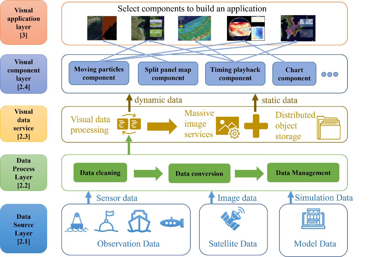
Fig. 1 The architecture of the visualization framework. The numbers in brackets refer to the sections where the components are introduced in detail.
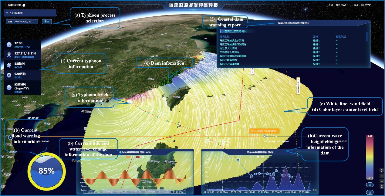
Fig. 2 Use of the marine component library to build a service application: an early warning and forecasting system for coastal dikes in Fujian. (a) UI component, (b) chart component, (c) moving particle component, (d) rotating layers component, (e) 3D graphics component, (f) table component and (g) GeoJSON line component.
(Editor: ZHANG Yiyi)
|
|


Address: 7 Nanhai Road, Qingdao, Shandong 266071, China
Tel: 86-532-82898902 Fax: 86-532-82898612 E-mail: iocas@qdio.ac.cn